-
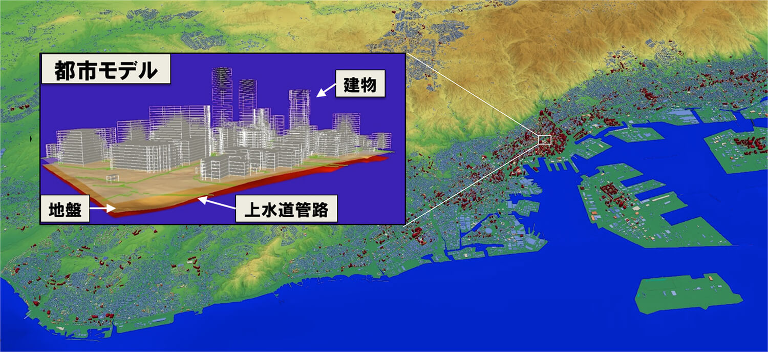
In order to make a practical disaster assessment based on simulations, we need detailed urban models, which include all individual buildings, grounds and lifelines in a target city. However, the quantity and quality of single raw data sources are limited and fragmented. Thus we need to construct a detailed urban model from multiple data sources. To make urban modeling automatic and efficient, we have developed a framework which can extract important information from fragmented heterogeneous data sources, integrate multiple data sets and make input models for disaster simulations.
Reference
Development of next generation urban area model
-
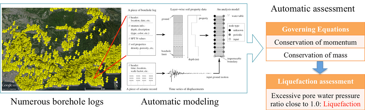
Liquefaction is a phenomenon that soil loses its strength caused by earthquakes within a short period. It has brought disastrous consequences such as ground failures and infrastructure damages in the past. However, conventional assessment techniques tend to overestimate the liquefaction risk. To achieve more effective liquefaction hazard assessment, we are working on an automatic assessment approach based on soil dynamics analysis, which are also suitable for efficient urban-wide assessment taking the advantage of HPC.
Development of simulation-based liquefaction hazard assessment method
-
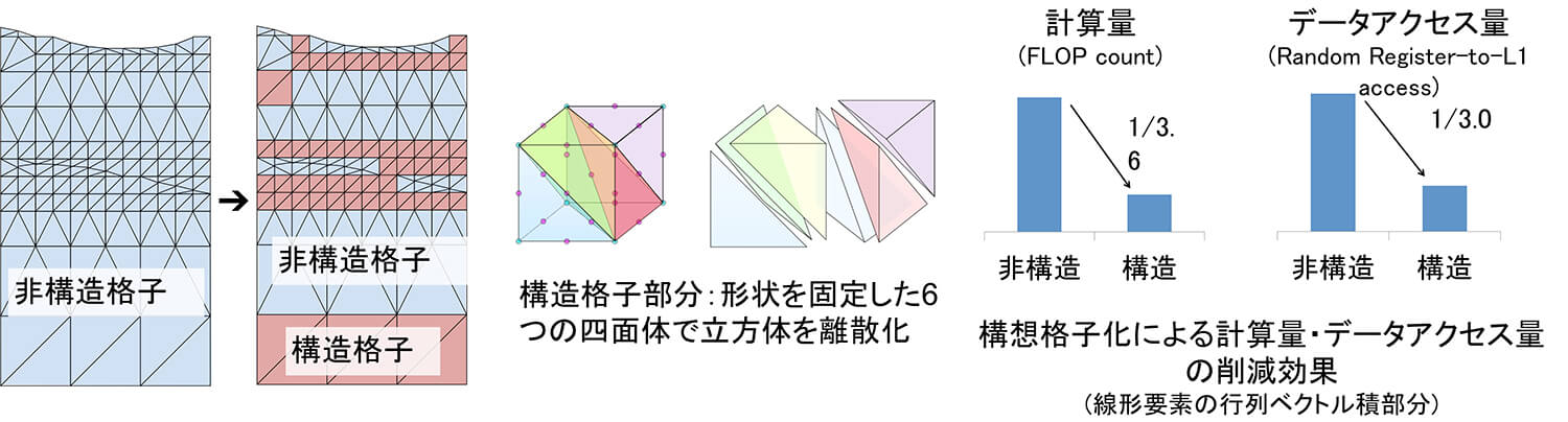
As a key technology towards enabling large-scale natural hazard simulations, we are developing fast unstructured-finite-element methods. Here, we use structured mesh for homogeneous parts of the problem to reduce computation and data access. By using the developed method on whole Fugaku computer, we enabled large-scale finite-element earthquake simulation with One-Tera Degrees-of-Freedom.
Reference