Computational disaster mitigation and reduction research team is aimed at advancing large-scale numerical simulation for natural disasters such as earthquake, tsunami and heavy rain, targeting Kobe City and other urban areas in Hyogo Prefectures. Beside for the construction of a sophisticated urban area model and the development of new numerical codes, the team seeks to be a bridge between Science and Local Government for the disaster mitigation and reduction.
About Computational disaster mitigation and reduction research team
-
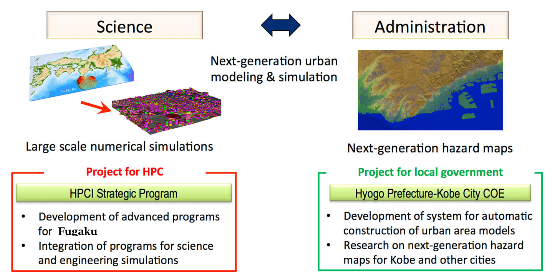
To make use of the simulation technologies developed by science communities, for the benefits of the general public, the collaboration between researchers and administrative officials are indispensable. Thus, we regularly organize seminars, “Sogobosai-kaigi”, with our research collaborators and with government officials from Hyogo-Prefecture and Kobe city, to report the research progresses on numerical-simulation-based next-generation hazard maps (see below). Sogobosai-kaigi is an open forum to exchange information and ideas on next generation hazard maps, for companies and institutions interested in our research as well.
Bridging between Science and Local Government
-
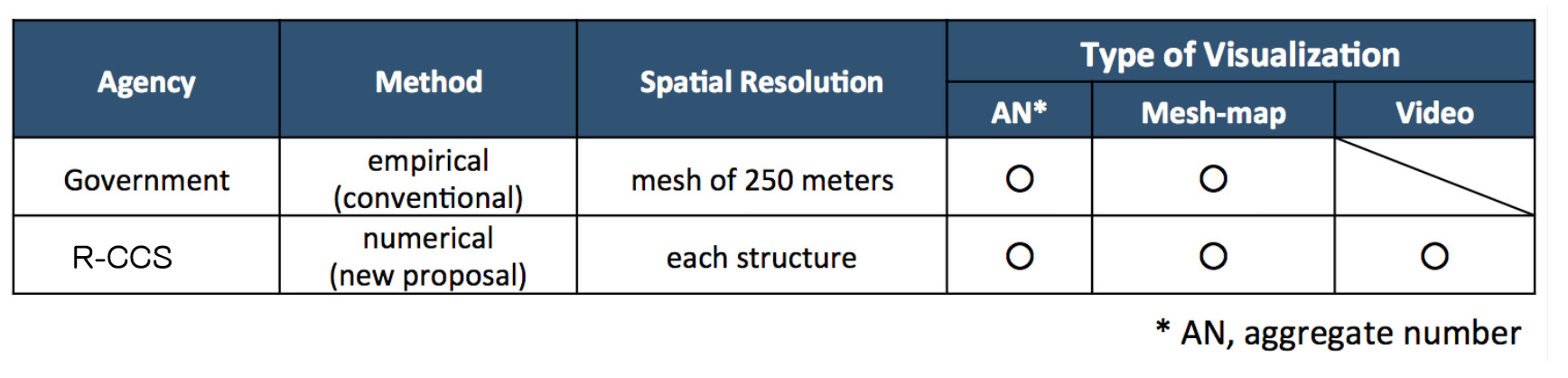
To construct a safe and secure community, it is important to understand (and prepare for) the possible natural disasters that would occur in future. For this purpose, our research team is working on “next-generation hazard maps”, which is based on large-scale numerical simulations, e.g., the response of buildings to earthquakes, the advancing of inundation areas of tsunami. In addition to generate conventional “aggraded numbers ” and “mesh-maps”, “next-generation hazard maps” can provide a four-dimensional (the three spatial dimensions and the temporal dimension) view of disasters, which is not possible with conventional methods.
An example of next generation hazard map
-
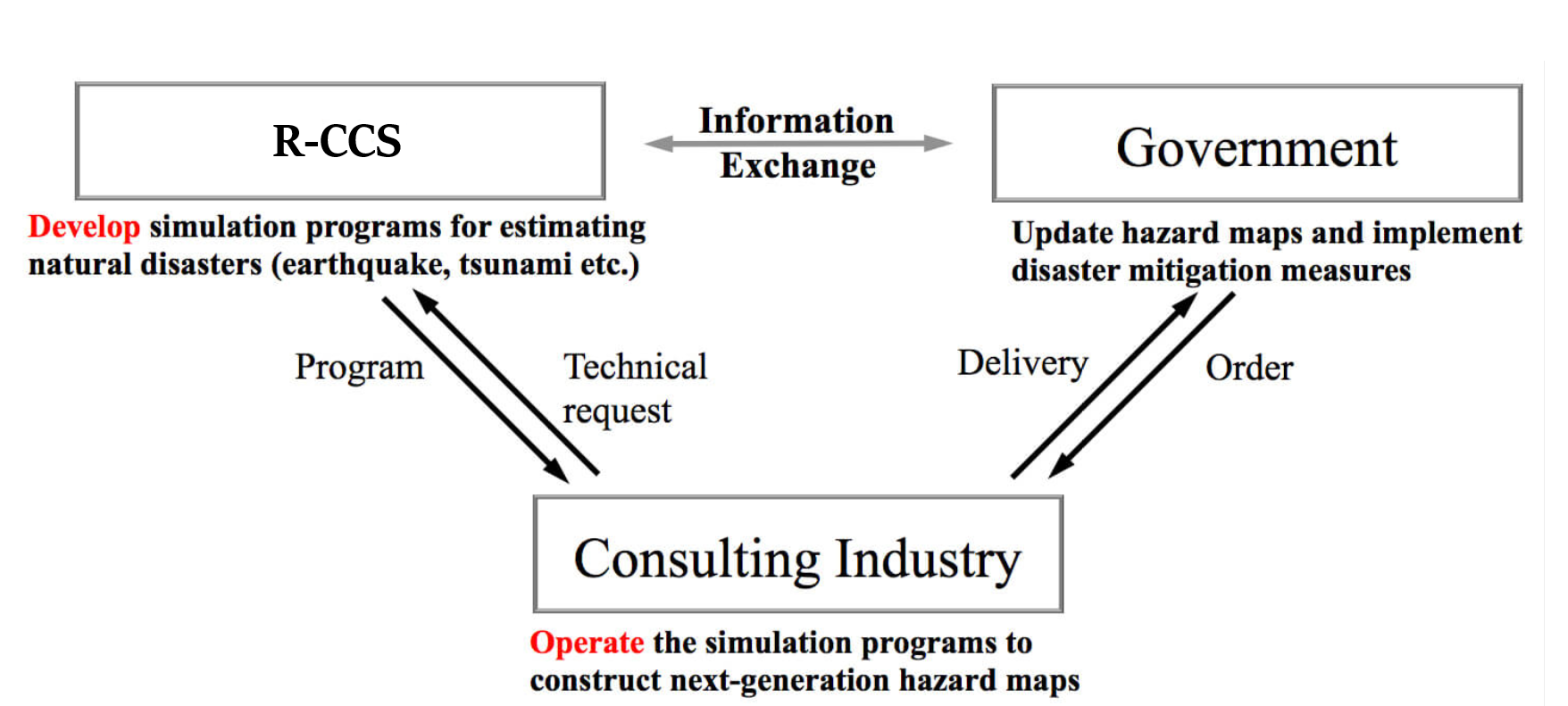
Our research team has been made progresses on the development of technologies for next-generation hazard maps, with regularly exchange of information and ideas with local governments. The application and operation of the new technologies has to be done by a third partner, the consulting companies, which provide hazard maps according to local governments’ specific needs. In other words, it is important to separate the roles of “research and development” and “application and operation” and our team will focus on the former in future.